Summit-Agro Alliance with DJI
Summit Agro celebrates its alliance with DJI, suppliers of different models of multispectral drones and for product application.
Summit-Agro Alliance with DJI Leer más »

Summit Agro celebrates its alliance with DJI, suppliers of different models of multispectral drones and for product application.
Summit-Agro Alliance with DJI Leer más »
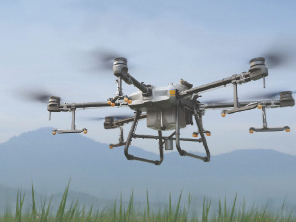
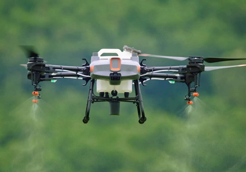
A new flagship of digital agricultureEquiped with a 30-litre spray tank, the DJI Agras T30 takes aerial spray efficiency to new heights. A revolutionary transformer body allows for more effective spraying, especially for fruit trees. Using DJI’s digital agriculture solutions, the T30 helps to reduce fertilizer use and increase yield with effective practices based on
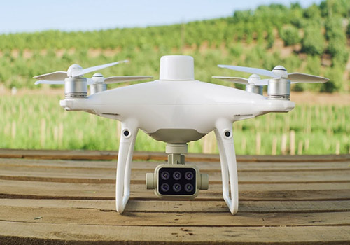
The new Phantom 4 Multispectral RTK is the first DJI model designed with the requirements of the agriculture and mapping market in mind, providing a compact solution with a 5-channel multispectral camera and additional RGB with the ability to capture RTK data with centimeter accuracy. Available in 2 presentations:– Multiespectral Phantom– Multiespectral Phantom + D-RTK
Multiespectral Phantom (P4M) Leer más »
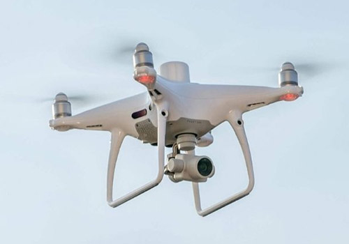
Enhance your next mapping mission with the Phantom 4 RTK – DJI’s most compact and accurate solution for low-altitude mapping. Available in 1 presentation:– Phantom 4 RTK + D-RTK 2 mobile station + Tripod New Generation CartographyDJI has rethought drone technology from the beginning and introduced revolutionary improvements that make it possible to set new
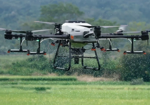
The DJI Agras T10 offers a very compact yet powerful aerial solution for agricultural sites of all sizes and needs. An 8-liter tank and a spray width of up to 5 meters allows the aircraft to cover up to 15 acres / hour. [1] Its folding truss structure is hardwearing and reliable, allowing an efficient
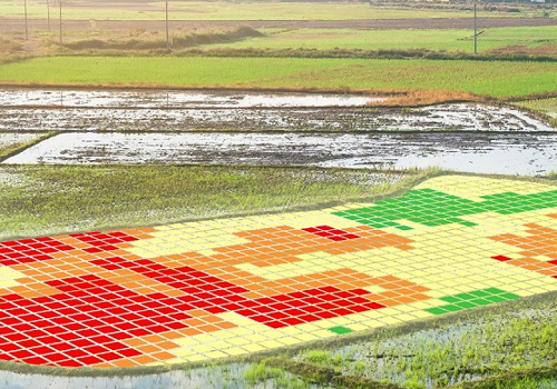
Cropview Platform Platform for visualize information Historical information and weather forecast Visualization of maps and diagnostics: Canopyscan – Satellitescan – Soilscan
Performance prediction projects. High accuracy and very low error performance prediction project services, which is used by Canopyscan and/or Satellitescan technologies
Canopyscan Detailed canopy monitoring service to generate vigor and chlorophyll maps. Uses active sensor: Emits its own light Measures reflectance at different wavelengths. Allows you to work at night Collects large amounts of data to generate NVDI (vigor) and NDRE (chlorophyll) indices Satellitescan Canopy monitoring service through satellite images Determine vegetation indices based on pixels:
Soil mapping service that provide detailed insight into the properties and characteristics of the soil. • More than 20 maps with the Physical-Chemical properties of the soil. • Site-specific recommendations to correct the critical soil factors. • Large amount of data generation (>700 points/ha).