
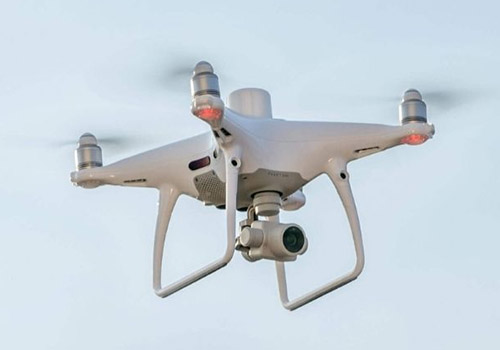
Enhance your next mapping mission with the Phantom 4 RTK – DJI’s most compact and accurate solution for low-altitude mapping.
Available in 1 presentation:
– Phantom 4 RTK + D-RTK 2 mobile station + Tripod
New Generation Cartography
DJI has rethought drone technology from the beginning and introduced revolutionary improvements that make it possible to set new standards for precision with drones. The Phantom 4 RTK offers its users information with a level of centimeter accuracy with fewer ground control points than were previously needed.
Get accurate data with Timesync
The new TimeSync system has been created to continuously synchronize the flight controller, camera and RTK module, in order to take full advantage of the Phantom 4 RTK positioning modules. In addition, TimeSync ensures that all photos will use the most accurate meta-information and set the positioning data to the center of the CMOS – optimizing the results of photogrammetric methods and allowing the image to achieve a level of centimeter accuracy.
High precision GNSS mobile station D-RTK 2.
Optimized precision. complete reliability.
The D-RTK 2 Mobile Station is an improved DJI GNSS receiver that is compatible with all major satellite navigation systems. It offers real-time differential corrections that generate relative positioning information of centimeter accuracy.